

Projects in the Development - 2023
East I-70 Corridor FOG/Shelter Plan - A guide to operating when deployed to East I-70 Corridor to assist with other jurisdictions, agencies and ARES groups during a variety of conditions or incidents. Randy Councell, NØOEM is the State ARES I-70 corridor Liaison and for Adams-Arapahoe County ARES.
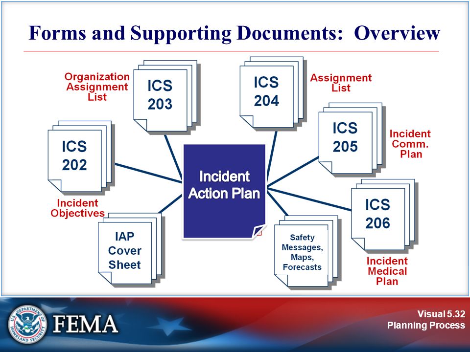
ARES Emergency Response and Operations Manual - This includes all of the information an ARES member will when Planning, Preparation, Responding and Recovery to an incident or deployment to be working in the field with one of our served agencies or other ARES groups. This booklet will include all the information as a guide for ARES members needs, to include, Incident Command (ICS) forms, ICS Guidelines, ICS Positions/Tasks, Winlink operations and Communication Plans. Including Weather activation and reporting protocols. Preparing the necessary Go Kits for deployment. The Manual can be found on the Operations Page or by clicking here: ARES Emergency Response and Operations Manual
Dispatch/Communications Guide - Field Operations Guides (FOG) for the various dispatch centers (PSAP/911), emergency operation centers (EOC), and command vehicles (CP) as an annex in the guide above. To include a list of Tactical Call signs for Critical Key Infrastructure (CKI) sites. identify locations for radio reporting or spotting operations.
Map Book/Infrastructure - Adams-Arapahoe County ARES map book that the entire group can utilize and carry when working with our served agencies and surrounding areas. Including the ARES Zone Map. List of Critical Key Infrastructure (CKI). Including data for the CKI sites obtained on the ARES Site Survey Form. List of major highway and interstate highways in the County. There are digital options available, but not everyone has access to these resources in the field, having something we can carry as a guide.
Hazardous Sites - As an annex to the Map book, make a list that can be identified on a map of all hazardous locations (All Hazards Approach) and index of listed sites. Identified the areas where weather related or other disasters can impede traffic flow, evacuation routes or create hazardous situations. Having a list of these hazardous locations we can better respond to the requests of our served agencies for monitoring these locations, as well as keeping our own members safe at home or deployment.
If you are interested in helping with any of these projects or have ideas for other project(s), please contact Operations or Planning Section Chiefs.