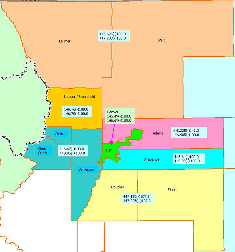
Skywarn Frequency Map
We believe thanks to Tim @ Skyview Weather. Here is JPEG graphic of the Denver Metro and northern Colorado Counties and the applicable Skywarn Frequencies that you can print and keep with you. If you have any trouble downloading/viewing this image please e-mail Webmaster. Download link to Skywarn Frequency Map
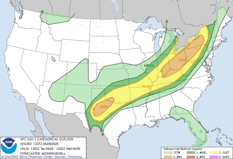
Convective Outlook
Weather Stations
Internet Weather Stations
These stations are reporting the following and can be very useful during weather nets.
· Temp
· Wind Speed & Direction
· Dew Point
· Pressure
· Precipitation Rates and Totals
· Humidity
· And historical data
Arapahoe ARES member stations
Cherry Creek School District football stadiums weather stations
These stations can be very useful during weather nets.
Map of Denver Metro and northern Colorado Counties and the applicable Skywarn Frequencies

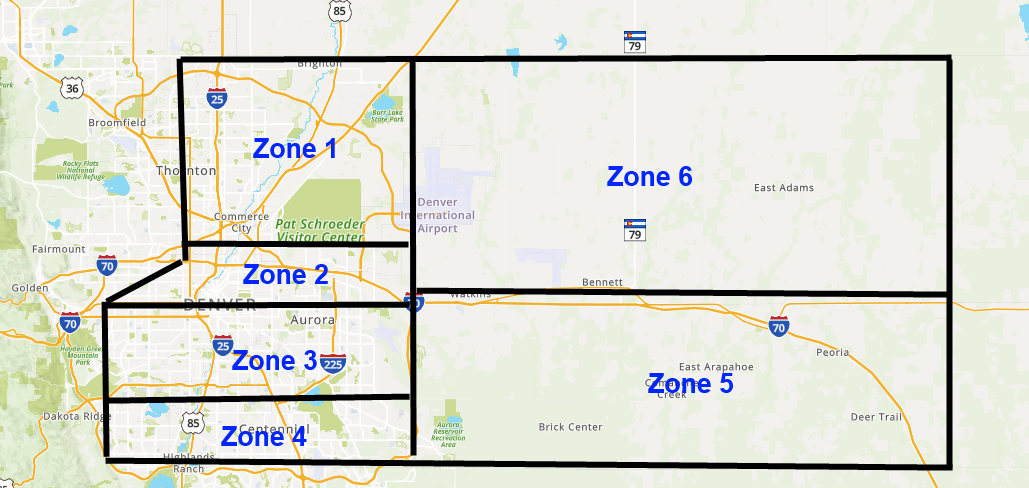
ACARES Zone Map
Zones for Region 10 District 1 - Revised January, 2025
Recently during Weather Nets and other trainings, you have probably heard Net Control say they will take check-ins by "Zones." The Zones they are referring to are as follows:
Zone #1 – Adams County – North County border with Weld & Morgan counties; east border will be E-470; south border will be 96th Ave; west border will be Broomfield & Jefferson Counties.
Zone #2 – Adams County – North border will be 96th Ave; east border will be E-470; south border will be Colfax Ave; west border will be Jefferson County.
Zone #3 – Arapahoe County – North border will be Colfax Ave; east Border will be E-470; south border will be Hampden Ave; west border will be Jefferson & Denver Counties.
Zone #4 – Arapahoe County – North border will be Hampden Ave; East Border will be E-470; south border will be County Line Road (Douglas & Elbert Counties); west border will be Jefferson & Denver Counties.
Zone #5 – Rural Arapahoe County – North border will be Adams County; east border will be Washington County; south border will be County Line (Douglas & Elbert Counties); west border will be E-470.
Zone #6 – Rural Adams County – North border will be Weld & Morgan Counties; east border will be Washington County; south border will be Colfax/Highway 36; West border will be E-470.
In the list above, each number is assigned to the Zone it describes. It is important that you know which Zone you are in when calling in. Your information, particularly from weather nets, is conveyed back to the Sheriff's Department and our other served agencies in this geographical way to help them better understand the situation. If you have any questions please let one of the Leadership Team members know. Their email addresses can be found via the Leadership link on the menu above.
Adams-Arapahoe County ARES is in Region 10, District 1. For additional information on the state regions, please visit Colorado Section ARES - https://coloradoares.org/section.
Weather Story

Weather Links

Make A Plan
Explains what an emergency communication plan is and why you should make one. It also provides tips and templates on how to make a plan.
Family Emergency Communication Planning Document
Family Emergency Communication Plan Wallet Cards
Family Communication Plan for Parents (English)
Family Communication Plan for Kids (English)
Build A Kit
A disaster supplies kit is simply a collection of basic items your household may need in the event of an emergency. Try to assemble your kit well in advance of an emergency. You may have to evacuate at a moment’s notice and take essentials with you. You will probably not have time to search for the supplies you need or shop for them.